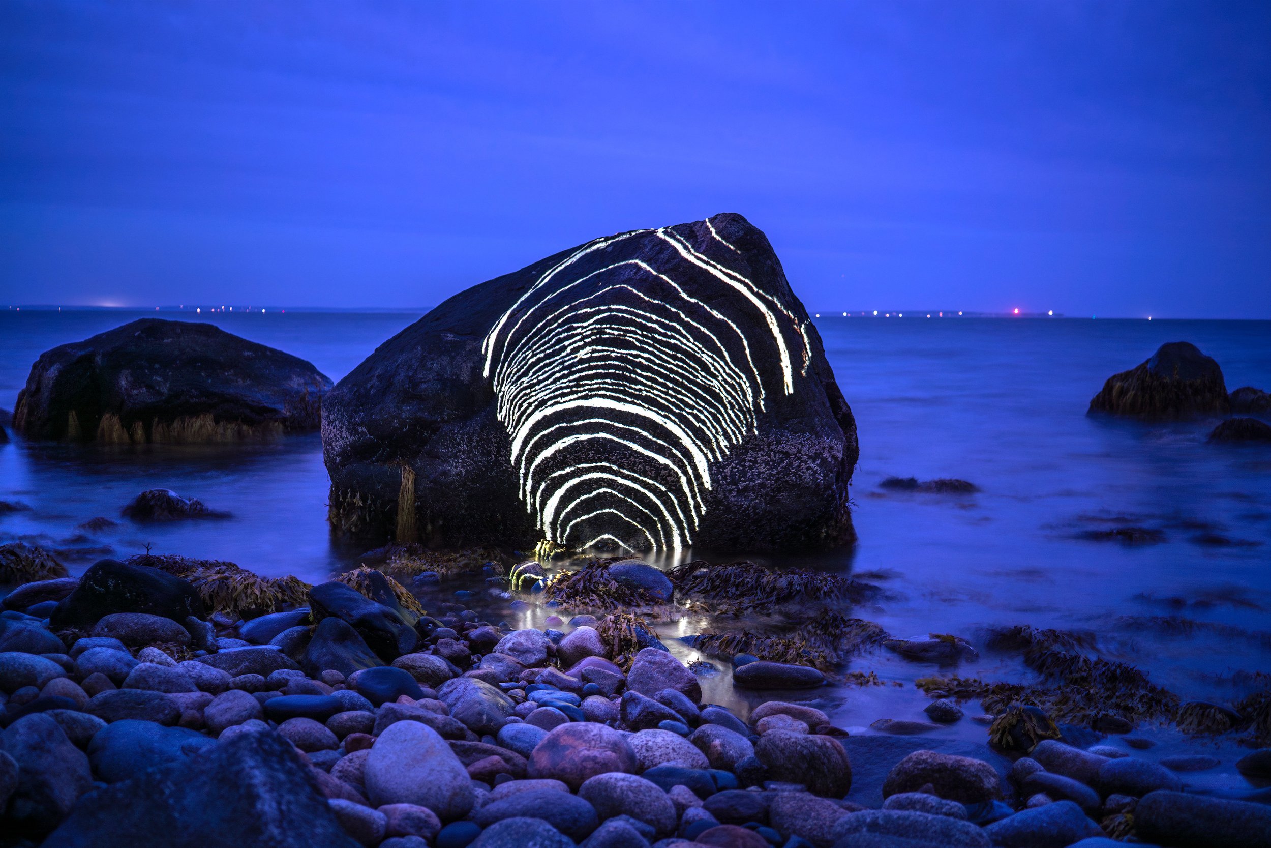
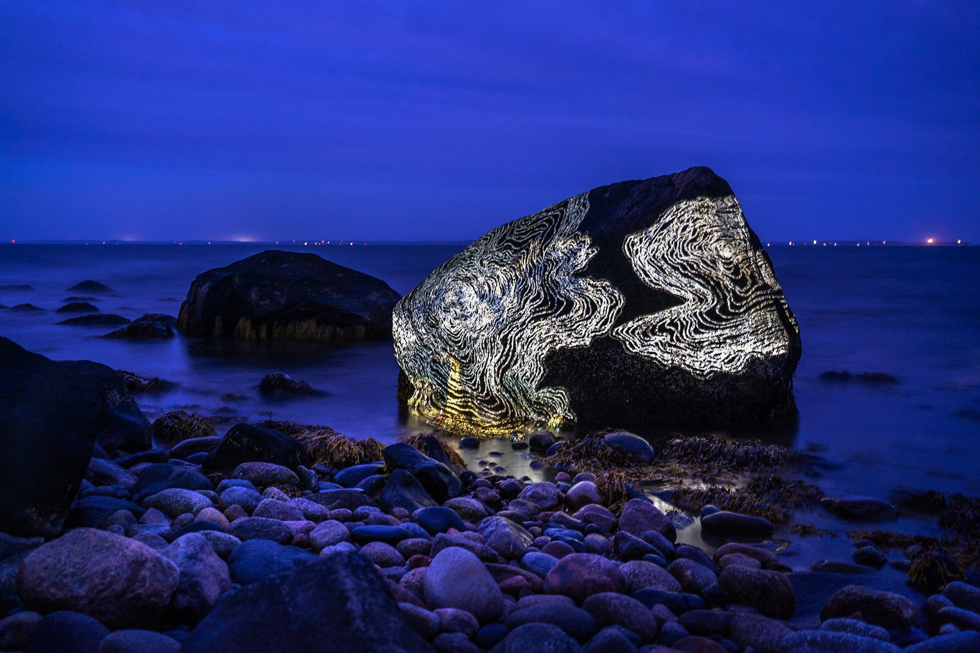
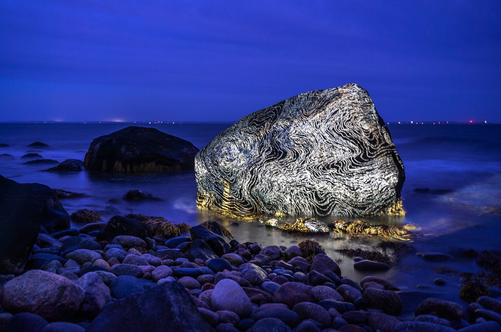
Animated Drawings for a Glacier, video documentation excerpt of both Kennicott, Alaska and Cuttyhunk, Massachusetts sites
Animated Drawings for a Glacier is a series of six animated charcoal drawings created for projection on glacial features in Kennicott, Alaska and Cuttyhunk, Massachusetts (2018 – 2021).
Documented in video and photographs and presented in photographic print, video, and installation formats.
Animated Drawings for a Glacier pairs glacial landscapes on opposite coasts of the US: icebergs calved from the Kennicott Glacier, Alaska, and boulders transported on ice to the shore of Cuttyhunk Island, Massachusetts, by the Laurentide Ice Sheet over 10,000 years ago.
The project began as a visceral response to encountering the visual and sonic power of glaciers in Alaska, while attempting to grasp the vast geological timescale of their motion and earth-carving force. Based on research into and direct observation of glaciers, I created six charcoal drawings on site in the Wrangell St. Elias National Park & Preserve. As I drew, I paused to photograph the drawing every few marks to document a stop-motion video of the process, as an evocation of the constant evolution of glaciers and their surrounding landscapes. Each drawing reflects the features and formation of a glacier: marks of accumulation, fracture, flow, and change, echoing and titled after the poetic terms used by glaciologists — ablatation, crevasse, firn, moraine, ogive.
In the 10 pm Alaskan twilight, I hiked with a small audience to project the Animated Drawings onto glacial ice, with just a battery-powered projector, tripod, and a cell phone for my theater. I considered these illuminated acts an opportunity tell the story of the glacier back to itself. My intention was to keep the process unintrusive to the landscape, while shedding light on the tremendous past and future power of the glacier to shape and reform the world we have known.
Over time, a pairing emerged with a distant and seemingly different landscape: the shoreline of my home state of Massachusetts. Like all of the northern US, Massachusetts’ landscape is carved by the onset and retreat of the Laurentide Ice Sheet during the last ice age 10,000 years ago. The ice that I marveled at in distant Alaska once blanketed and shaped the seemingly quotidian landscapes I know intimately today. To illuminate this shared story across space and time, I projected the Animated Drawings again on the glacially-transported boulders known as “glacial erratics” that dot the coast of the Cuttyhunk Island, which was formed by the moraine (or terminus) of the Laurentide Ice Sheet.
Now the Kennicott Glacier retreats rapidly, and Cuttyhunk is one of the many coastal communities threatened by the sea level rise caused by melting ice.
Two channel video installation with hanging screens in Earthly Observatory at SAIC Galleries, 2021
Archival inkjet prints on dibond and transparent film on lightbox in Illuminations at the Marion Art Center, 2023
First Projection - Root Glacier by Kennicott, AL
Cuttyhunk Projections
Animated Drawings
charcoal drawing on paper / artifact of the animation process, 2018
Film stills from the Ogives animation, charcoal on paper
Map including the Kennicott and Root Glaciers in the Wrangell St. Elias National Park and Preserve, Alaska
Map showing former outer reaches of the Laurentide Ice Sheet; Cuttyhunk’s location indicated with the yellow circle.
Data mapped by Ridge (2004), Sone and others (2005), Boothroyd (2008), Stone and DiGiacomo-Cohen (2005); and Stone and Others (2011) Base from National Oceanic and Atmospheric Administration and US Geological Survey.


